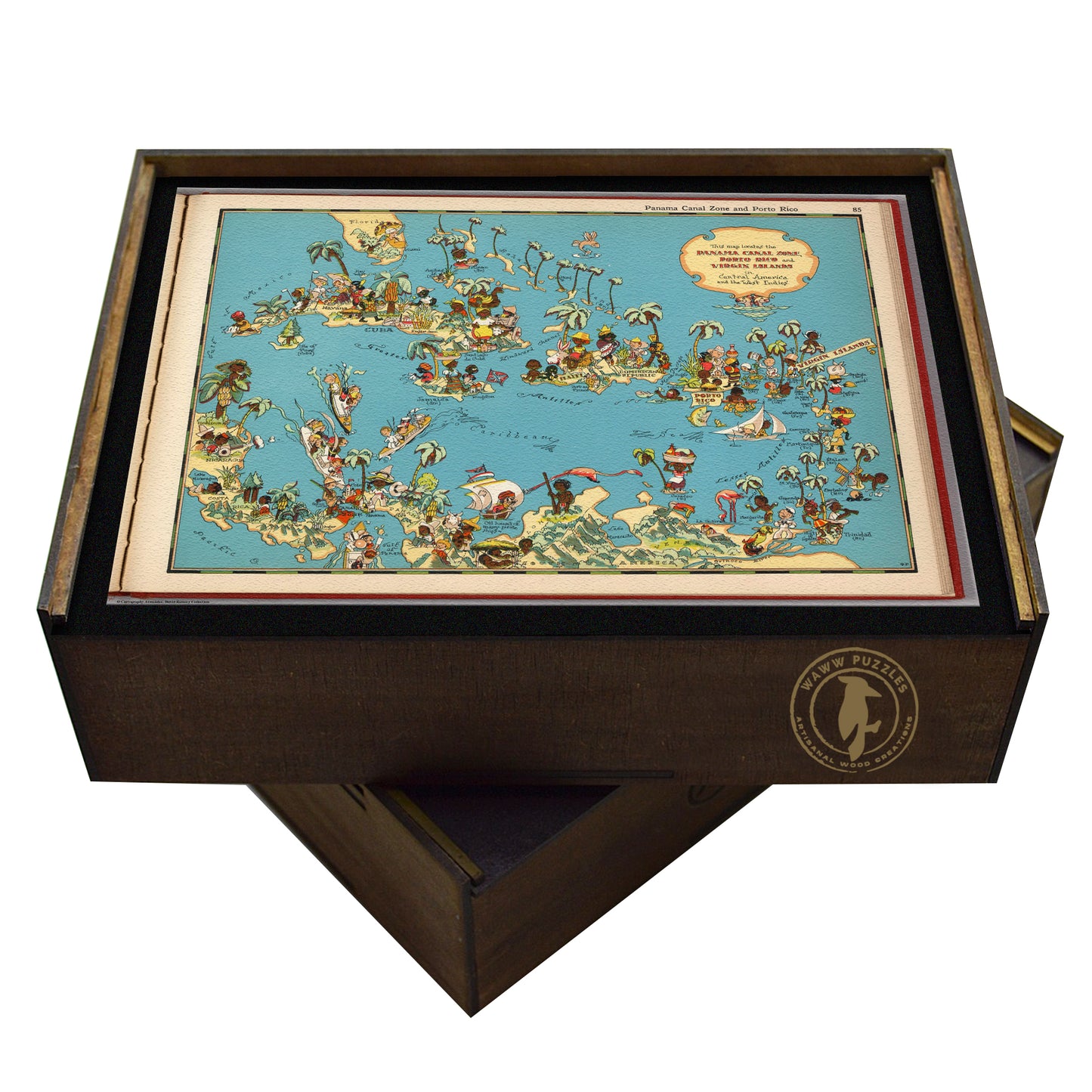


Vintage Caribbean Pictorial Map | Artisanal Wooden Jigsaw Puzzle | Ruth Taylor White art
Vintage Caribbean Pictorial Map | Artisanal Wooden Jigsaw Puzzle | Ruth Taylor White art
- Regular price
- Price: $95.00
- Regular price
- List Price: $150.00
- Sale price
- Price: $95.00
- Unit price
- per
Key Features:
Key Features:
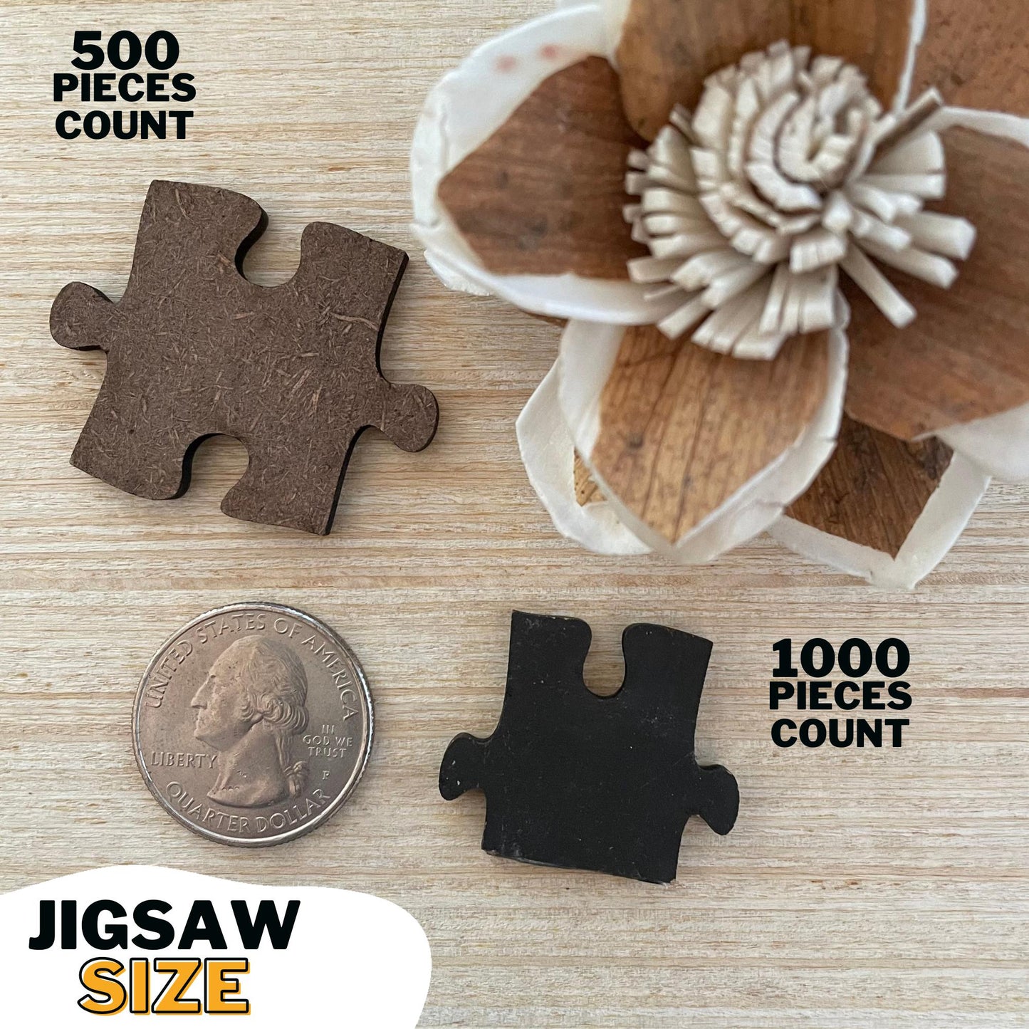
- Premium Quality: Crafted from durable 3mm (.14in) composite wood board for lasting enjoyment.
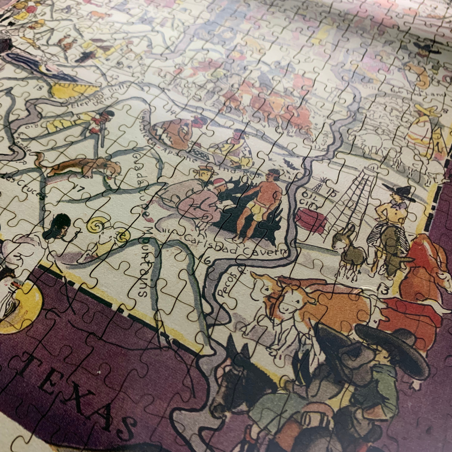
- Vibrant Imagery: High-resolution UV printing directly on the wood—no paper laminate—for stunning detail and vibrant colors.
- Eco-Conscious: Made with environmentally friendly materials.
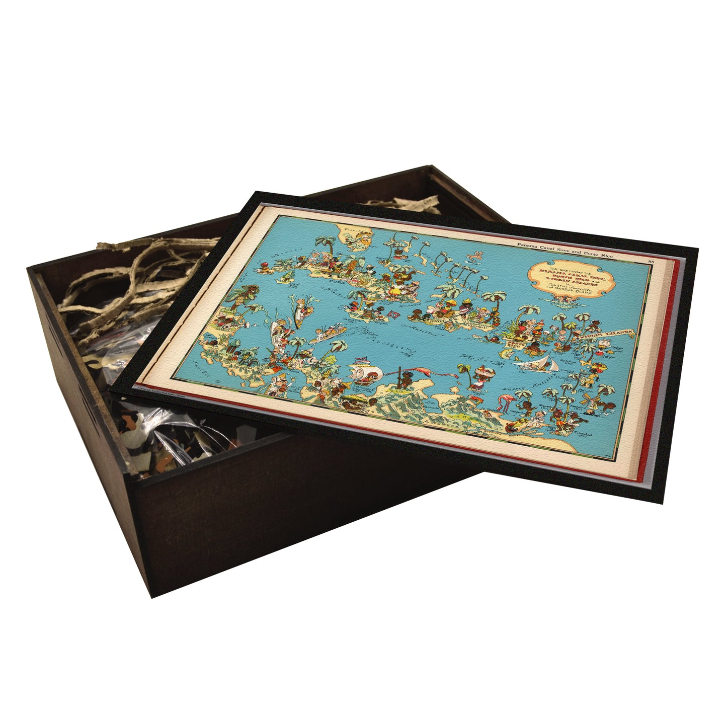
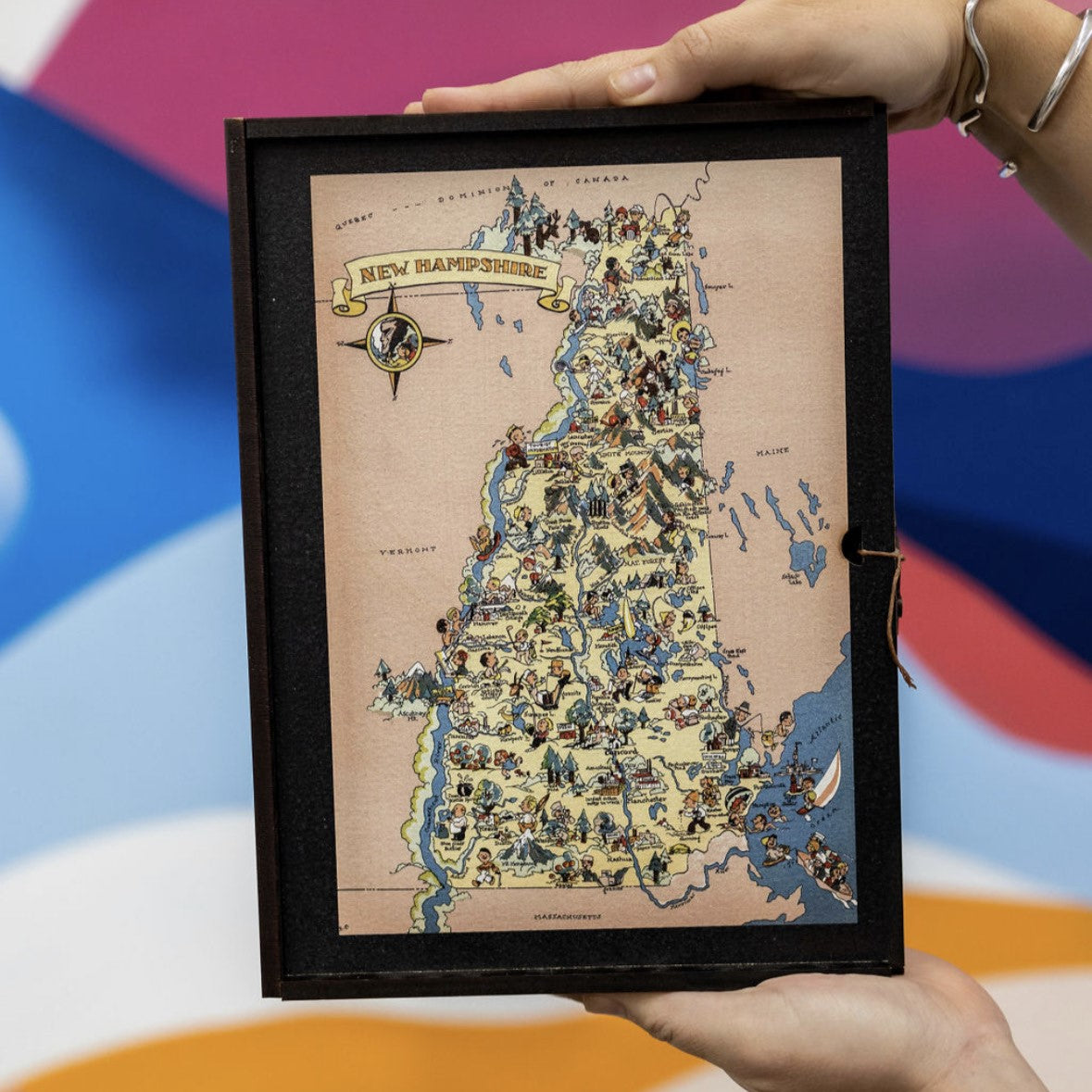
- Heirloom Keepsake: Your puzzle arrives beautifully packaged in a handcrafted wooden box, perfect for gifting or storing your masterpiece.
Craftsmanship and Care:
Craftsmanship and Care:
Experience the satisfying click of perfectly interlocking pieces. Our state-of-the-art laser cutting ensures precise fit and a smooth, seamless puzzle-solving experience. The perfect upgrade from cardboard without breaking the bank.
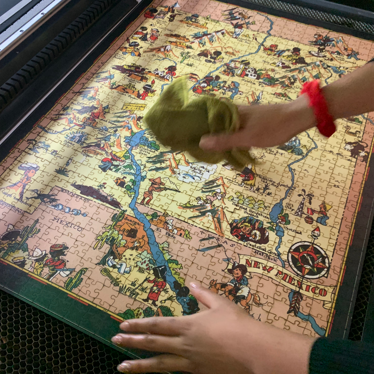
- Natural Laser Residue: A small amount of harmless black residue from the laser cutting process may be present. Simply wipe it away with a damp cloth.
- Hand-Finished Details: Each puzzle board, each wooden box are all carefully hand-stained, painted, and glued.
Satisfaction Guaranteed:
Satisfaction Guaranteed:
We are confident in the quality of our puzzles. If you are not completely satisfied, we offer a full refund or exchange.
Import & Customs FAQ
Import & Customs FAQ
US Facility: Our bestselling designs are precision-cut in New England for faster delivery.
Mexican Workshop: Most of our collection is custom printed and laser-cut at our family-owned workshop in Mexico.
✅ Best of Both Worlds: Enjoy quick delivery of popular designs plus an extensive selection both showcasing the same authentic craftsmanship.
While recipients are ultimately responsible for researching tariffs in their location, our puzzles marked as WAWW PUZZLES MEXICO are 100% made in Mexico and qualify for duty-free treatment under USMCA (the trade agreement between USA, Mexico and Canada). For standard US shipments, you won't pay any import duties on our products.
⚠️ Future Changes: While currently duty-free, international trade agreements can change. If USMCA is altered or terminated, import duties may apply.
Couldn't load pickup availability
In stock
 PRODUCT DESCRIPTION
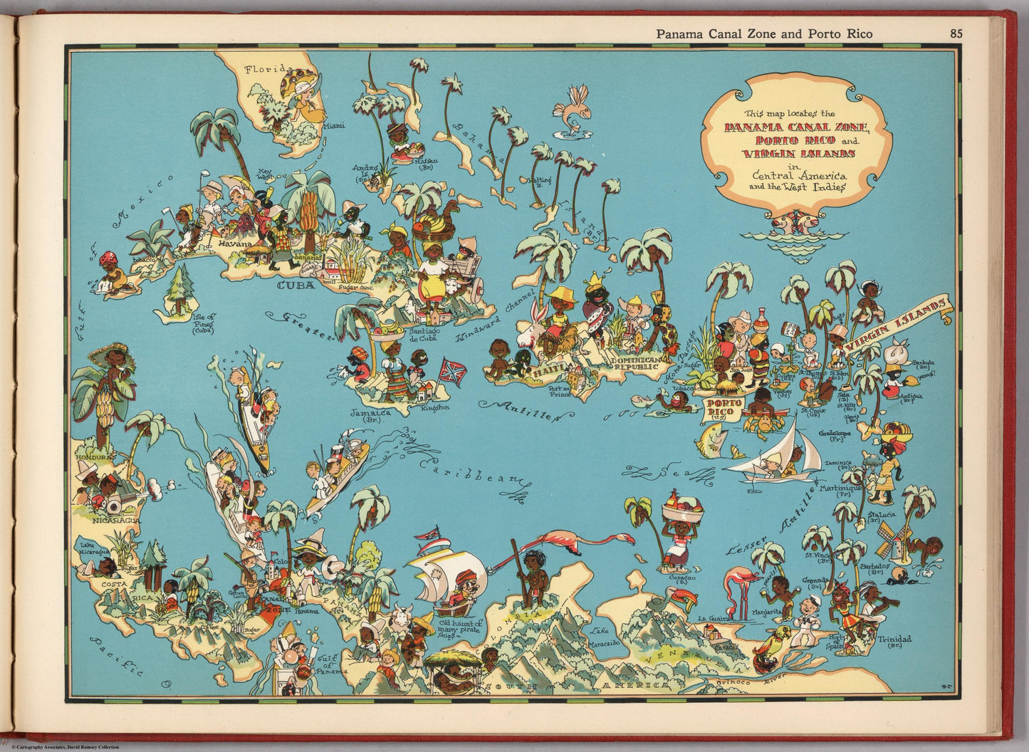
Embark on a journey through the vibrant landscapes and rich history of Central America and the West Indies with this vintage pictorial map! Featuring colorful illustrations of its diverse cultures, exotic wildlife, and colonial past, this map captures the allure of this captivating region. Perfect for history buffs, travel enthusiasts, and those who appreciate the beauty of the Caribbean, this print adds a touch of tropical charm to any space.
Landmark Highlight:
This map invites you to explore the fascinating world of Central America and the West Indies. Discover the engineering marvel of the Panama Canal, connecting the Atlantic and Pacific Oceans. Immerse yourself in the vibrant cultures of Cuba, Jamaica, Haiti, and the Dominican Republic, each with its unique traditions and history. Imagine the swashbuckling adventures of pirates on the Spanish Main and the bustling trade routes that shaped the region's economy. The map also highlights the natural beauty of the islands, from lush rainforests and volcanic peaks to pristine beaches and coral reefs.
This delightful 1900s atlas playfully explores the United States. Each state gets its own full-color map brimming with charming illustrations – think crops, animals, landmarks, and even a touch of romance! While the historical depictions may reflect outdated stereotypes, we at WAWW, a POC-owned business, value them for their historical context. These prints originate from the post-Golden Age during the Great Depression. Artwork by Ruth Taylor (1900).