Vintage 1944 WWII Europe Map - Artisanal Wooden Jigsaw Puzzle
Vintage 1944 WWII Europe Map - Artisanal Wooden Jigsaw Puzzle
- Regular price
- Price: $130.00
- Regular price
- List Price: $150.00
- Sale price
- Price: $130.00
- Unit price
- per
Key Features:
Key Features:
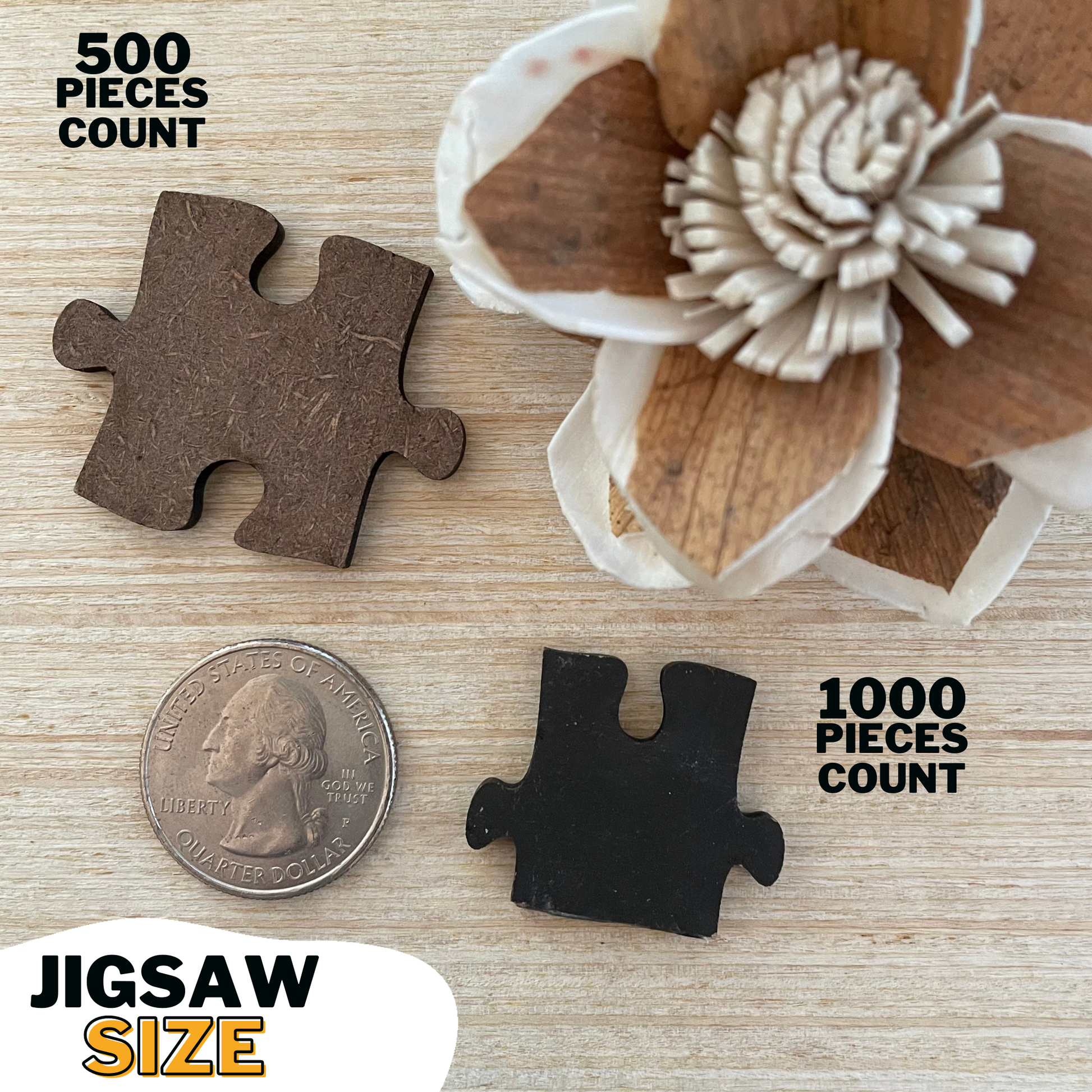
- Premium Quality: Crafted from durable 3mm (.14in) composite wood board for lasting enjoyment.
- Vibrant Imagery: High-resolution UV printing directly on the wood—no paper laminate—for stunning detail and vibrant colors.
- Eco-Conscious: Made with environmentally friendly materials.
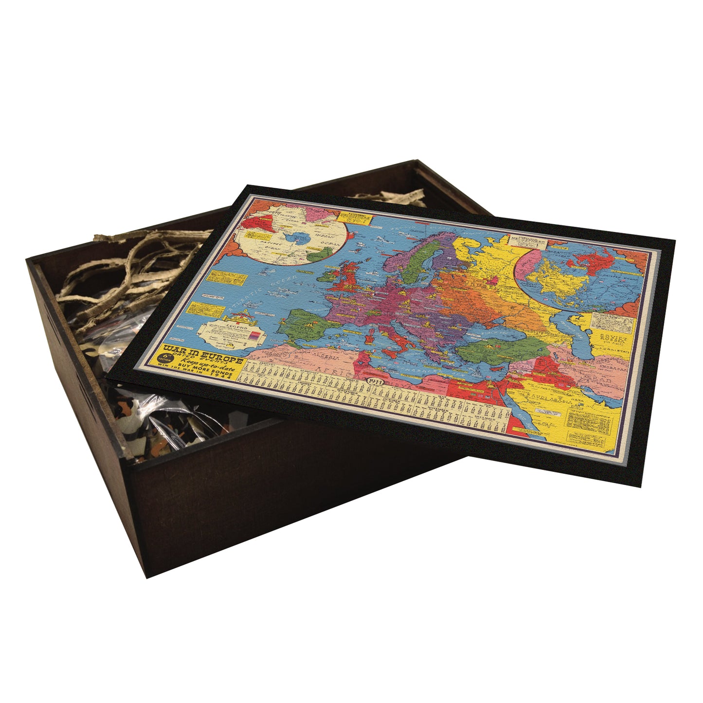
- Heirloom Keepsake: Your puzzle arrives beautifully packaged in a handcrafted wooden box, perfect for gifting or storing your masterpiece.
Craftsmanship and Care:
Craftsmanship and Care:
Experience the satisfying click of perfectly interlocking pieces. Our state-of-the-art laser cutting ensures precise fit and a smooth, seamless puzzle-solving experience. The perfect upgrade from cardboard without breaking the bank.
- Natural Laser Residue: A small amount of harmless black residue from the laser cutting process may be present. Simply wipe it away with a damp cloth.
- Hand-Finished Details: Each puzzle board, each wooden box are all carefully hand-stained, painted, and glued.
Satisfaction Guaranteed:
Satisfaction Guaranteed:
We are confident in the quality of our puzzles. If you are not completely satisfied, we offer a full refund or exchange.
Import & Customs FAQ
Import & Customs FAQ
US Facility: Our bestselling designs are precision-cut in New England for faster delivery.
Mexican Workshop: Most of our collection is custom printed and laser-cut at our family-owned workshop in Mexico.
✅ Best of Both Worlds: Enjoy quick delivery of popular designs plus an extensive selection both showcasing the same authentic craftsmanship.
While recipients are ultimately responsible for researching tariffs in their location, our puzzles marked as WAWW PUZZLES MEXICO are 100% made in Mexico and qualify for duty-free treatment under USMCA (the trade agreement between USA, Mexico and Canada). For standard US shipments, you won't pay any import duties on our products.
⚠️ Future Changes: While currently duty-free, international trade agreements can change. If USMCA is altered or terminated, import duties may apply.
Couldn't load pickup availability
In stock
 PRODUCT DESCRIPTION
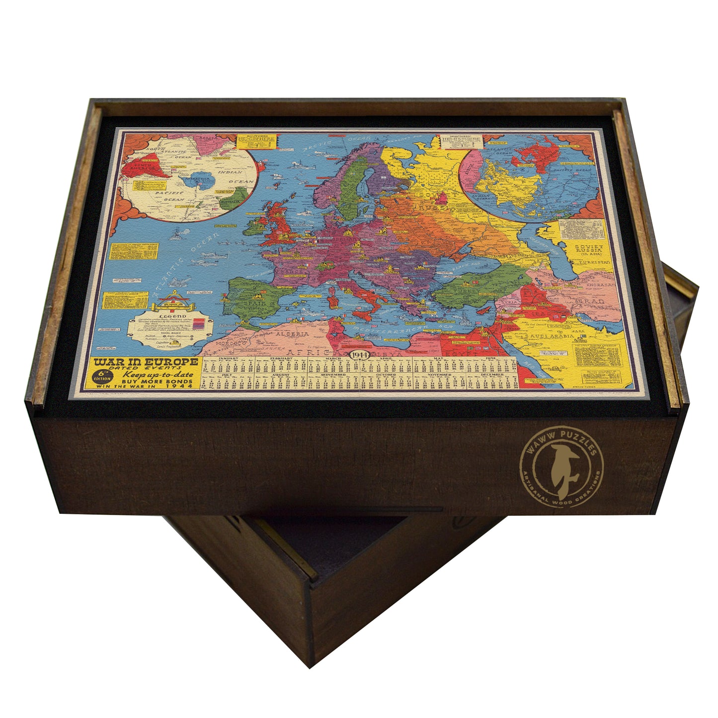
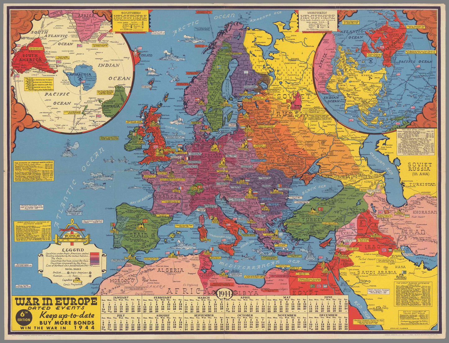
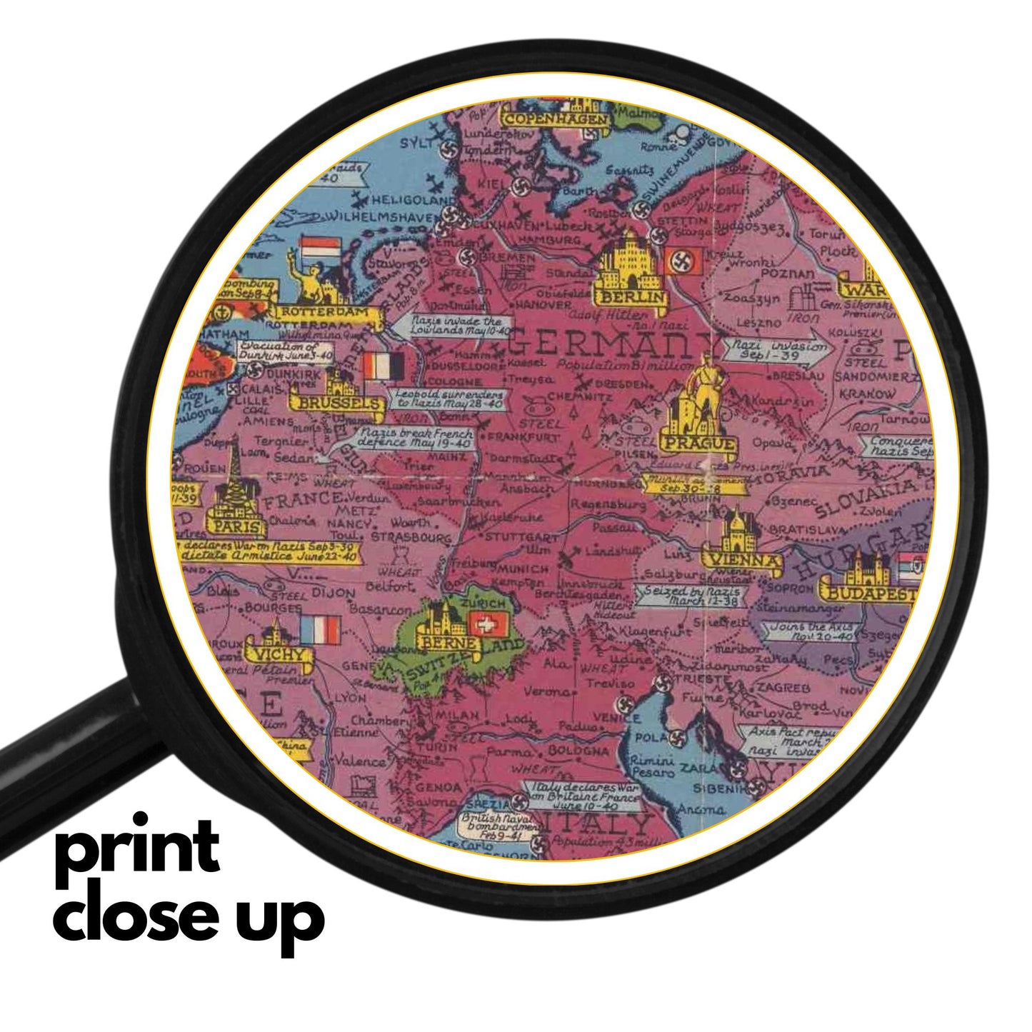
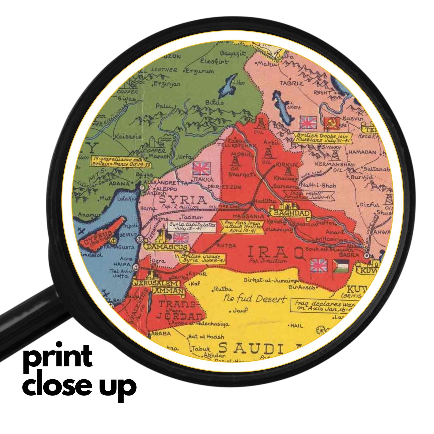
Own a piece of history with this powerful WWII pictorial map from 1944! Showcasing the global scope of the conflict, Allied strength, and the ongoing war effort, this map is a testament to a pivotal moment in world history. Featuring vibrant colors, strategic information, and a call to action, this piece is a must-have for history buffs and collectors alike.
Landmark Highlight:
This map highlights the global scale of World War II in 1944, with a focus on Europe, Asia, and Africa. It visually represents the areas controlled by the Axis and Allied powers, showcasing the strategic challenges and opportunities faced by both sides. The map also emphasizes the importance of resources, production, and morale in winning the war, encouraging viewers to support the war effort through initiatives like war bonds and Lend-Lease.
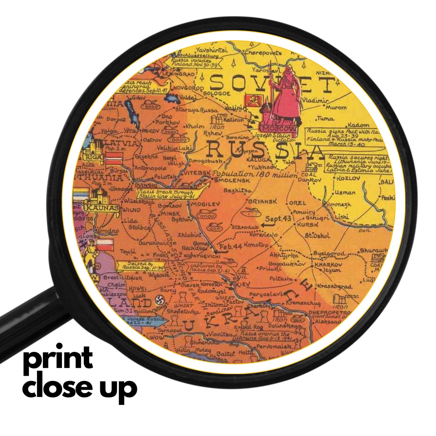
War in Europe Dated Events is a colorful and informative pictorial map created by Canadian artist Stanley Turner in 1944.
The map also shows the flags and leaders of the Allied and Axis powers, as well as a calendar for 1945. This map is an excellent puzzle for history buffs and map lovers, as it challenges them to piece together the historical facts and figures of the war. It also provides a visual and educational overview of the global conflict that shaped the modern world.
This puzzle is a historical map that depicts the complex geopolitical landscape of Europe and North Africa during World War II in 1944. Focusing on the war in Europe, the map highlights key regions and countries involved in the conflict, including the Soviet Union, Africa, and various European nations. Published as a "Keep Up-to-Date" information piece, it provides a snapshot of the wartime dynamics and was likely used for both strategic and public awareness purposes. The map's detailed cartography and clear demarcation of political boundaries offer valuable insights into the geographical strategies and territorial disputes of this pivotal period in global history.